Our friends at Plan C have created a useful guide for these times of global uncertainty. They share a few simple things we can all do for facing some of the challenges of rising fuel costs, potential food insecurity and more. It’s all about some small practical steps that can make a big different. Access their one-page guide here.
According to a report from the Climate Council and the Emergency Leaders for Climate Action (ELCA): “We are now living through a rapid intensification of climate-fuelled disasters. Emergency services and governments worldwide are already being periodically overwhelmed by the increasing frequency, intensity and destructiveness of climate-fuelled disasters, and this will continue to worsen until we stabilise temperatures. If we are to have any hope of successfully coping, all adaptation and resilience efforts must sit alongside urgent efforts to reduce climate pollution further and faster this decade.”
Uki featured as a case study in the report, and it makes for interesting reading.
The full report includes the five priorities for communities identified by ELCA.
February and March are typically our wettest months, and when east coast lows, cyclones and ex-cyclones have their strongest impact. Any weather event with heavy, prolonged rain may cause the Tweed River and its tributaries to flood.
While the Bureau of Meteorology (BOM) provides forecasts on a regional basis, their monitoring doesn’t provide the local detail we need. It would be wonderful if there was a way we could be notified of potential severe rainfall in our own upper catchment areas and consequent local river height changes.
I have set up the Upper Tweed Flood Information WhatsApp group to provide exactly that local data. Various government, commercial and citizen websites and apps are scanned to identify future flood events and to gather information on rainfall and river heights. Messages to the group are only sent when significant events are anticipated and when river heights rise to impact low-lying causeways.
This group is about providing information only – it is not professional or official advice. It’s still up to individuals to interpret this information along with all available advice, including official warnings and forecasts from the SES and BOM, to take appropriate action.
Anyone can join the WhatsApp group, just click here.
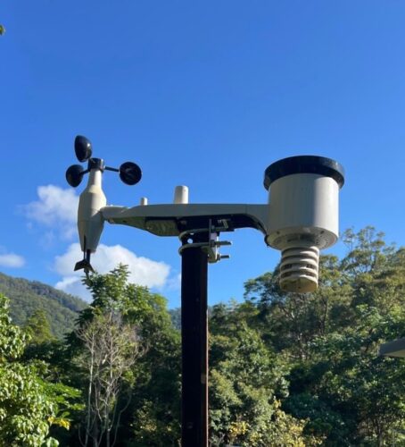
Could a rain gauge at your place help?
We know it takes about 3 to 5 hours for rain in upper catchment areas at Byrrill Creek, Mebbin and Mount Burrell to make its way down the Tweed River to around Uki. More online rain gauges in these areas would give us a better understanding of where rain has fallen and how much we can expect the Tweed River to flood. Our friends at the Australian National University are helping with a study on this topic and they have provided some rain gauges to us to distribute.
We’re seeking people who live in Commissioners Creek, Doon Doon, Kunghur Creek, Mount Burrell and Byrrill Creek to host a rain gauge.
Ideally (not essentially), you’d have back-up power or be off grid and have satellite Internet so the gauges will continue working when power/communications is disrupted. If you’re interested, please email [email protected].
***
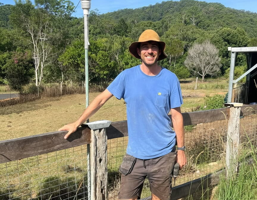
PICTURED: Will from Chowan Creek is one of the community members who’s hosting a rain gauge at his property, providing more local data to assess during rain events.
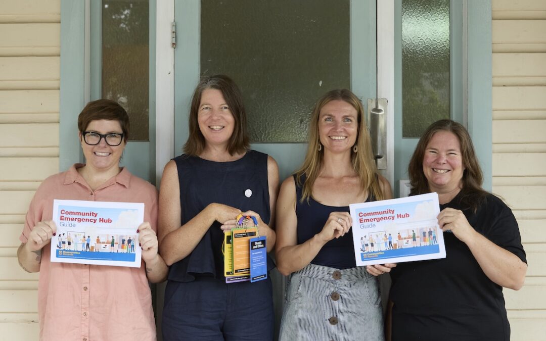
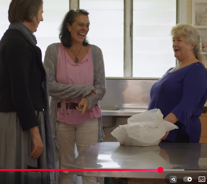
Resilient Uki is proud to share that we launched our new Community Emergency Hub Guide on 8th December 2025 — a practical, step-by-step playbook designed to help communities organise and support each other when disaster hits.
Developed with the input of 10 community resilience groups across Tweed and Byron, the Guide builds on the Wellington (NZ) Community Emergency Hub model and has been adapted for Northern Rivers realities. This project was coordinated by Mel Bloor and Bec Talbot for Resilient Uki, bringing together lived experience from recent disasters and turning it into clear, usable tools for the moment when power, internet and formal support may be limited.
The guide is designed to be used in the middle of a crisis – with whoever shows up – and to work with or without power, internet or immediate government support. It includes simple role cards, checklists and templates to help volunteers safely open a hub, welcome the public and coordinate local offers and requests.
Pictured above are (l-r) NRCF’s Grants and Community Impact Manager, Melanie Bloor and Bec Talbot (Resilient Uki) and NRCF Grants Administration Officer Mel Horswell at the Hub Guide Resource launch.
Following the 2022 Northern Rivers floods, Healthy North Coast’s Community Wellbeing & Resilience flood recovery grants supported local organisations, including Resilient Uki, to deliver culturally safe, trauma-informed and community-led initiatives. The grants invested in social connection, community capacity and shared learning, providing stability and consistency for recovery while strengthening networks for the future. Thirteen initiatives were funded, across seven Local Government Areas that were heavily impacted by the 2022 floods. RUKI’s Neighbourhoods Project, which helped link 12 ‘neighbourhoods’ in the Greater Uki area, was one of the initiatives funded. In this video, released late 2025, we hear from community members, including RUKI president Melanie Bloor, on the impacts of that funding.
In 2022/2023, RUKI participated in the Community-led recovery: evidence, dimensions and supports for Community Recovery Committees project led by a team at The University of Melbourne. The project provided guidance and tools to Community Recovery Committees, building on previous work conducted after the 2019-20 Black Summer bushfires. The research explored four case studies in four different states across regional, urban, interface and remote communities who had experienced either a flood or bushfire, along with surveying disaster recovery workers. RUKI was one of the case studies.
This webinar, hosted by Natural Hazards Research Australia, summarised some of that research and featured:
Dr Colin Gallagher, University of Melbourne
Hannah Morrice, University of Melbourne
Melanie Bloor, Resilient Uki
Dr Blythe McLennan, Natural Hazards Research Australia
While some questions from the Q&A session were addressed in the webinar, time ran over and so the speakers responded to some of the outstanding questions in an extended written response to the Q&A, which you can view here.
The Plan C Research team recently completed a detailed report on Mutual Aid (neighbours helping each other in times of crisis) in Greater Uki. Led by Dr Claire McLisky and funded by the French humanitarian think-tank Groupe URD, the study was undertaken as part of a global investigation into how grassroots communities respond to crisis.
Read more and download the full report (in English or French) here.
_________________________________
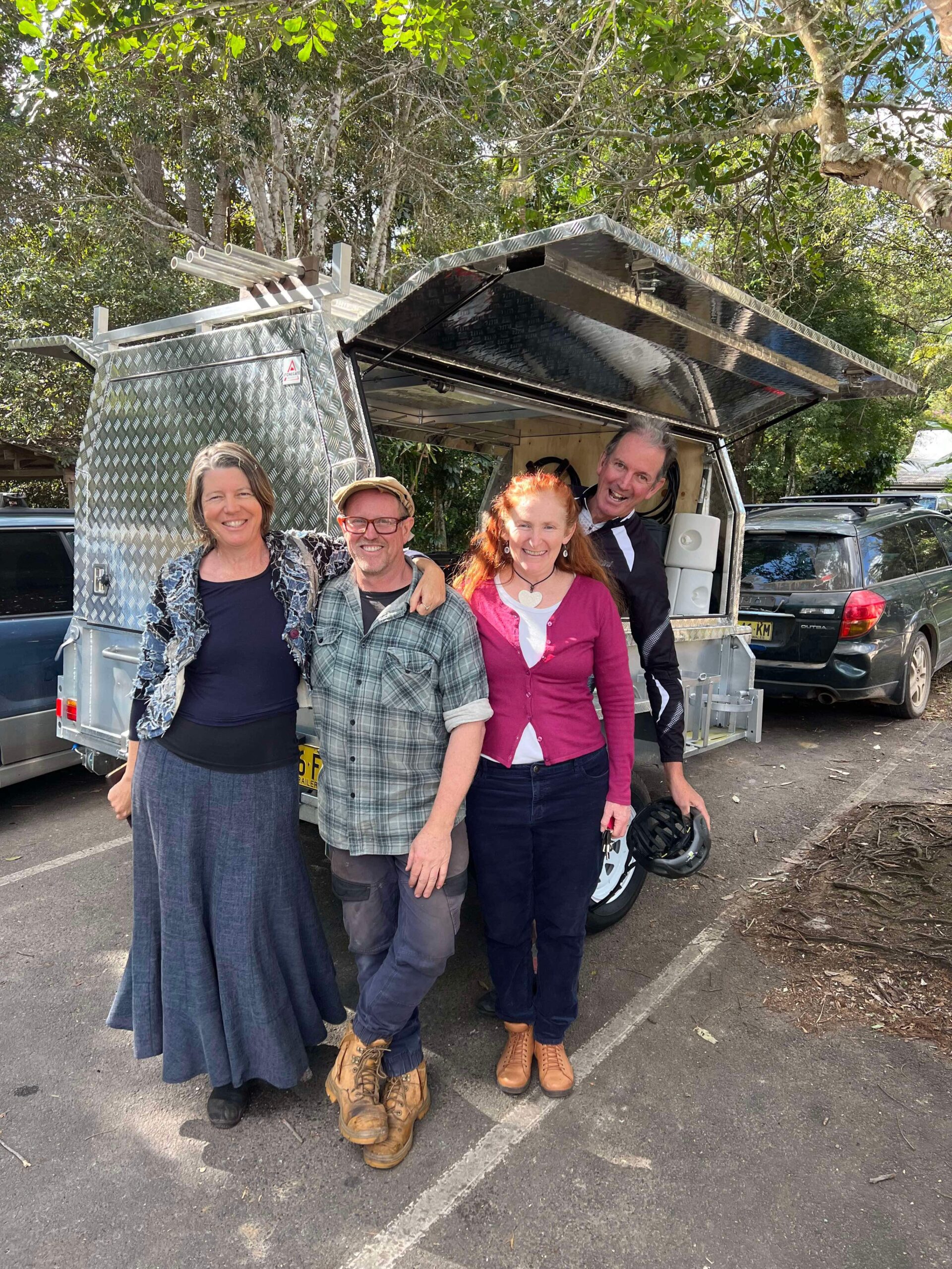
Image: (l-r) RUKI President Melanie Bloor, Vice-President Brendan Esposito and Committee Members Carmen Myler and Luke Naismith with the RUKI Gathering Trailer. Image supplied by Dr Claire McLisky
Well, we are right in the midst of a very big weather event in our region, just a few days out from the third anniversary of the 2022 floods that are still so fresh in our minds.
Fortunately, we’ve had a much longer lead time and we’re seeing a lot more preparedness in our community and the SES, BOM and Tweed Shire Council have been issuing us all with very regular updates.
Right now, Council has closed many of their services, and schools across the region are closed.
As SES NSW wrote in a recent post on social media: We are facing three natural disasters in one with a combination of gale-force winds, heavy rainfall, and widespread flooding expected over the coming days.DESTRUCTIVE WINDS are expected to cause significant damage, possibly bringing down trees, powerlines, and damaging buildings. Once the winds subside, HEAVY RAINFALL will lead to moderate to major flooding in areas from Taree to Tweed Heads.
Here are some things you can do to prepare and make sure you stay safe:
As a starting point, secure items around your home including bins, outdoor furniture and pot plants, remove any debris around outside and aim to store 10L of drinking water per person per day for 3 days supply in preparation of power outages or interruptions to water supply.It is essential to prepare yourself and your home/property/family including animals for the possibility of damaging winds, heavy rain and, if you’re in a low-lying area, flooding. And make an emergency kit even if you’re not in a flood-prone area (i.e. if your house sustains damage, you may need to leave) There are lots of tips to help you to do that here.
We’re not used to cyclones in this region! Some additional things you can do to prepare for a cyclone are listed here (but remember that is a Qld site so some of the extra links won’t be so relevant to us).
Follow the advice in SES warnings… download the Hazards Near Me appand keep an eye on alerts in your area. You can also see current warnings at ses.nsw.gov
Save the Tweed Emergency Dashboard to your homescreen: https://emergency.tweed.nsw.gov.au/home
THIS HAS JUST ABOUT EVERYTHING YOU NEED — rainfall, river heights, links to all the key agencies, warnings, etc.
Check out our Useful Apps & Links page to make sure you Avoid driving. If you have to travel, remember the Tweed Flood Monitoring Cameras provide regular updates (every 15mins) at a range of pressure points on our roads that commonly flood.
If you need to evacuate and you can’t get to friends/family to stay with there are evacuation centres setup across the region, including in Uki Hall. See all evac centre details here.
Check in with your neighbours. If you have a neighbour who lives alone or is vulnerable in some way, please check in with them to see if they might need help moving things or getting prepared. Helping others can also help to alleviate our own fears/worries.
If our area becomes cut-off/isolated and regular communications channels go down, we have a neighbourhood UHF radio/alternative communications system set up. Get information about that here.
Look after your mental health: There’s a lot of fear and anxiety across the region right now. It is a good idea to try not to get too absorbed in ‘doom scrolling’ on social media. While it is a great source of local knowledge (flooded roads, etc.), it can feed a feeling of anxiety and emotional contagion so if you’re feeling anxious, maybe limit how frequently you check socials.
Here are a few Facebook pages you might want to follow to stay updated.
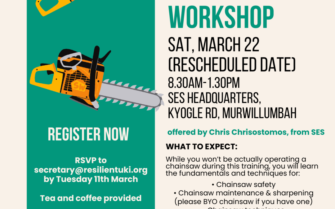
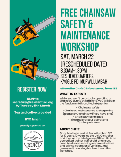
This event is now happening on Saturday, March 22nd
There is a free chainsaw safety & maintenance workshop coming up
Saturday, March 22 8.30am-1.30pm SES Headquarters, Kyogle Rd, MURWILLUMBAH
WHAT TO EXPECT:
While you won’t be actually operating a chainsaw during this training, you will learn the fundamentals and techniques for:
• Chainsaw safety
• Chainsaw maintenance & sharpening (please BYO chainsaw if you have one)
• Chainsaw techniques
• Trim and crosscut operations
• Tips for pole saws
ABOUT CHRIS
Chris has been part of Murwillumbah SES for 17 years. 10 years as the Unit Controller and then as the Intelligence Officer. He is an accredited trainer in: first aid, chainsaw, flood boat, map reading, communications and driving operational vehicles. And generously donating his time to run this workshop.